Hi @revant_one ,
I have successfully added a geolocation field (thanks to your contribution to this post!) to show all features (markers) from a featurecollection on a map , but i want to show the marker name (passed in properties as name on the featurecollection) when I click on the marker.
I have no idea on how to do that.
I tried:
Creating an attribute on the map’s HTML for each marker (and the calling it with jquery to show a tooltip.
Using the bindPopup method on a marker (but couldn’t find a way to call it).
I have not been able to make it work…Do you have any pointers?
Yes that i am aware but when you enable the location field in customer and do the get request of the same customer after creating the customer. Location is not part of the json response.
I have also tried using FrappeClient in bench console and still no location data being returned back in the response
Excellent good to hear - of course whatever ‘ah-ha’ learning tip notes that you can add for your own recall reference will help others follow in your steps too!
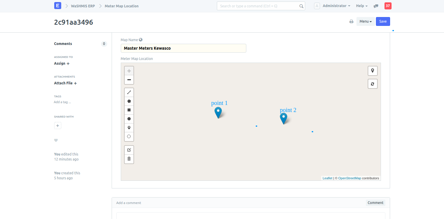
I have been going through the thread above but it doesn’t really my question so I was wondering if there way of adding description/details for points, polygons in the geolocation field on. For, example if I have more than one point and I want to give the first point a description as “point1” and the second as “point2” when the user hovers over the point as shown in the screenshot below.
The data is just geojson feature collection, you can save additional data manually (some customisation), if storing data is important. It won’t reflect on UI.
If you wish to add the feature, add appropriate leaflet plugin. Note that there is limited space on geolocation field, only important plugins are kept on UI.
@revant_one thanks alot for the prompt reply, I will have to think of another way to solve the issue. You also said the geojson field has limited space is there any other way of storing an unlimited number of points on a map for example if i want to see all the assets of a company in on one map in erpnext or can the max length of geojson field be customized.
Trust you’re doing great and thanks again for all the great work in the community. This no longer works as stated above in V12. Could you pls suggest if there’s a way to restore this behaviour for V12 instances?
On the contrary, seems the fix you pushed just shipped with last Thursday’s release (even though it wasn’t mentioned in the release notes). It appears the map layers are now working again… at least on some platforms