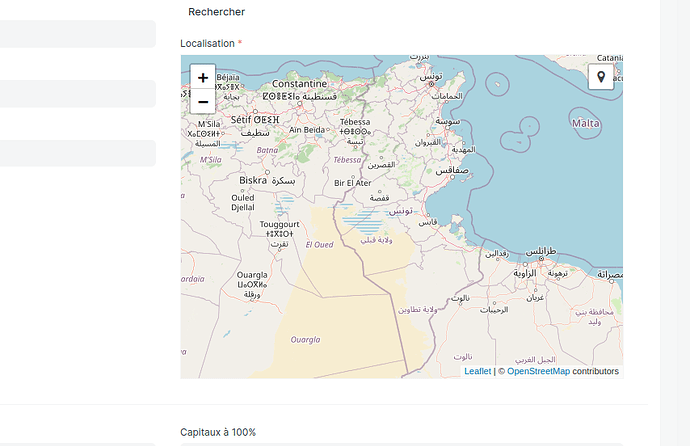
The draw toolbar of Geolocation is not displaying in childtable, and I’m unable to select the location correctly in the Geolocation field within the child table. how can i add it
i do ike this in form but not work
contratsTable.grid.grid_rows.forEach(function(row) {
        // Access the map field 'map_data' in each row
        var mapField = row.map_data;
        if (mapField && mapField.map) {
            let map = mapField.map;
            // Add Leaflet.draw plugin to the map
            var drawnItems = new L.FeatureGroup();
            map.addLayer(drawnItems);
            var drawControl = new L.Control.Draw({
                edit: {
                    featureGroup: drawnItems
                },
                draw: {
                    polygon: true,
                    polyline: false,
                    rectangle: false,
                    circle: false,
                    circlemarker: false
                }
            });
            map.addControl(drawControl);

            // Event handler for when a polygon is created
            map.on('draw:created', function(event) {
                var layer = event.layer;
                drawnItems.addLayer(layer);
            });
        }
    });
the first time that i work with geolocation any help,
